Forest Resource
Overview
Zambia is moderately forested with around 42 percent forest cover and an additional 37 percent classified as other wooded land. The majority of forests in Zambia are open savannah woodlands, with “miombo” woodland (Brachystegia-Julbernardia-Isoberlinia association) comprising around 80 percent of the country’s vegetation. Mopane woodland (Colophospermum mopane) occurs in the Zambezi depression, and Munga woodland ” (Piliostigma-Acacia-Combretum association) in particularly dry areas. Small areas of closed riparian and swamp forests occur in the Zambezi depression. Zambia has established a modest plantation estate based on Pinus species. Zambia has a large network of protected areas with around 20 national parks and more than 30 game management areas. Around 32 percent of Zambia’s forests are inside protected areas.
Forest Types

Geographic Description
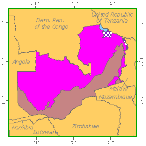
The Republic of Zambia, located in south central Africa, lies between latitudes 8° and 18° S and between longitudes 25° and 32° 30´ E. It is bounded on the north by the Democratic Republic of the Congo (formerly Zaire) and Tanzania; on the east by Malawi; on the south-east by Mozambique; on the south by Zimbabwe, Botswana, and the Caprivi Strip of Namibia; and on the west by Angola. The south-eastern tip of Zaire penetrates deeply into the country in its middle. In the north the country touches Lake Mweru and Lake Tanganyika, and in the south it reaches Lake Kariba on the Zambezi River. It covers 752 612 km2, most of it between 900 and 1 500 m elevation. Some areas are a little more elevated in the northern part of the country and along the eastern border.
Five physiographic regions are generally distinguished:
- The main plateau region stretching along the main Zaire-Zambezi watershed from Kabwe (Broken Hill) to Isoka;
- The southern plateau (region of Choma-Kalomo), very similar to the main plateau;
- The eastern plateau; and
- Two main extensions of the main plateau:
- The highlands surrounding the Lake Bangweulu area from Kasama to Mansa (Fort Rosebery) in the northern part; and
- The Copperbelt-Solwezi-Kasempa area, in the north-western part.
While tropical, because of its altitude Zambia has a milder climate than might be expected. The hot season lasts only from September through November. The average temperature in Lusaka during July, the coldest month of the year, is 16° C; the hottest month, January, has an average temperature of 21° C. Annual rainfall ranges from 600 to 900 mm in the south to over 1 250 mm in the north. The rainy season extends from October or November to April.
Ecological Zones

Forest cover Vegetation
Closed Forests
Broadleaved
Open woodlands cover the largest part of the country and some authors do not even mention closed forests. However, the following closed forest types were distinguished by FAO (1981)
- Parinari forest has an average height of 20 m. The main genera in the canopy are Parinari, Syzygium and Entandophragma. This forest type exists only as a relic in small patches in the reserved forests;
- Marquesia forest is about 18 m high with Marquesia, Syzygium and Anisophyllea as the main genera;
- Lake basin chipya, 20 m high, is characterised by the genera Erythrophleum, Burkea, Pterocarpus and Albizia;
- Kalahari sand chipya is about 13 m high with Erythrophleum, Burkea, Guibourtia and Pterocarpus;
- Cryptosepalum forest has an average height of 15 m and main genera in the canopy are Cryptosepalum, Gujibourtia and Marquesia;
- Baikiaea forest with Baikiaea, Pterocarpus, Combretum and Acacia;
- Montane forest (only small relics) up to 25 m high with the genera Aningeria, Podocarpus, Olinia, Cola and Myrica;
- Swamp forest 25 m tall with Mitragyna, Ilex, Syzygium and Xylopia;
- Riparian forest, 20 m high, characterised by the genera Xyzygium, Diospyros, Khaya and Parinari.
The two latter forest types occur along the rivers with water all year around that are found mostly in the north.
Forest Industry
Broadleaved
Woodlands cover extensive areas in Zambia. Their structure and composition vary from tree savannas in the drier areas of the south to formations vary close to deciduous forests in the north and north-west, where the rainfall is highest. Fanshawe distinguishes four main types of woodland in Zambia:
- Miombo woodland is a two-storeyed woodland with an open or slightly closed canopy of semi-deciduous trees up to 15 to 21 m and practically no climbers. It is characterised by the dominance of species of Brachystegia, Isoberlinia, Julbernardia and Marquesia. The latter is considered to be a relic from closed dry evergreen forest. Usually more than one species is dominant; however, based on dominance, it is possible to distinguish the following subtypes: Marquesia woodland, Brachystegia utilis woodland, B.longifolia-B. Spiciformis woodland, B. floribunda woodland, and mixed Julbernardia paniculata-Brachystegia bussei woodland.
The miombo woodland occurs on the main plateau, from Kabwe in the centre of the country toward Isoka in the north-east, on the southern plateau around Choma and Kalomo and in the Copperbelt region and west of it.
- Kalahari woodland at its best forms a two-storeyed canopy with a dominant stratum up to 18 to 24 m tall. Climbers are rare and epiphytes very scarce. Dominant species are Burkea spp., Combretum mechowianum, Erythrophleum africanum, Guibourtia spp., Parinari curatellaefolia, Pterocarpus angolensis and Terminalia sericea. Sometimes Brachystegia longifolia, B. spiciformis, Julbernardia paniculata and relic forest species such as Baikiaea spp. and Cryptosepalum pseudotaxus also occur. The Kalahari woodland is thought to be a secondary vegetation type, derived by fire, cultivation, erosion and fluctuations in the water table from dry deciduous Baikiaea forest that once covered the greater part of the Kalahari sands.
Mopani woodland is a one- or two-storeyed formation with the upper canopy between 6 and 18 m. Climbers may be locally common (e.g., Fockea spp.) as well as epiphytes (orchids). The dominant species is Colophospernum mopane. The understorey forms a dense thicket when it exists.
Regeneration of the dominant species is locally abundant and depends largely on the degree and duration of flooding. The mopane woodland is found only in the Zambezi depression. It has failed to penetrate into the north, probably due to the acidic soils of the uplands of the central African plateau.
- Munga woodland presents itself at its highest degree of development as a one- or two-storeyed deciduous woodland with scattered or grouped emergents up to 18 m high. It is characterised by the following genera: Acacia, Afrormosia, Albizia, Combretum, Ficus, Kigelia, Kirkia, Lonchocarpus, Ostryoderris, Piliostigma, Pterocarpus, Sclerocarya, Terminalia and Ziziphus. The understorey forms a thicket layer up to 4 to 5 m when it exists. There may be climbers and epiphytes. A dense layer of tall coarse grass is very characteristic. The munga woodland may have been derived from the dry deciduous forest of the Kalahari sands but it seems more likely that it developed from grassland to shrub and tree savanna together with the soil formation of the sand plains. Fires would eventually have restricted tree species to the fire resistant ones found nowadays.
 Other wooded land
ShrubsAll the above-mentioned woodlands are under the influence of various climatic, edaphic and biotic factors. When these factors permit their optimum development, the woodlands are approaching the dense dry deciduous forest but under severe adverse conditions they only appear as open shrub formations or thickets. The so-called “itigi” shrub vegetation type occurs also with Bussea, Baphia, Euphorbia and Burttia as the main genera.
References
Fanshawe, D. B. (1966). Savanna woodland in Zambia. Prepared for the African Forestry Commission Working Party on Savanna Forestry, Lusaka.