Forest Resource
Overview
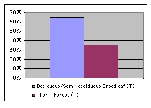
Chad is lightly forested with 9 percent forest cover and 11 percent of other wooded land. Almost all the forest and woodland is in the south of the country with vegetation becoming progressively more sparse north of Lac Chad. The northern third of the country extends into the Sahara Desert with very scattered and sparse vegetation. Most woody vegetation in Chad is open savannah forest, with Sahel-Sudanian savannah occupying the centre of the country, Sudanian-type savannah in the south-east and Sudanian-Guinean savannah in the wetter south of the country. The southern savannah is dominated by species such as Isoberlinia doka and Burkea africana. Sudanian savannah is characterised by Anogeissus leiocarpus and Sclerocarya birrea, while the dry Sahel-Sudanian type is mainly lower thorn scrub comprising species such as Acacia seyal and Faidherbia albida. Closed forests in Chad are effectively limited broadleaved riparian forests extending along permanent or semi-permanent watercourses, most notably the Chari and Logone rivers. Chad has a modest network of protected areas including two national parks. Around 2 percent of Chad’s forests are inside protected areas.
Forest Types

Geographic Description
The Republic of Chad, located in north central Africa, is bounded on the north by Libya, on the east by Sudan, on the south by the Central African Republic and on the west by Cameroon, Nigeria, and Niger. It has an area of 1 284 000 km2 and lies between latitudes 8° and 24° N and longitudes 14° and 24° E, stretching 1 700 km from north to south. A landlocked country, it is separated from Doula by 1 500 km, from the ports of Nigeria by 2 500 km, and from Pointe-Noire, via the Central African Republic, by some 3 000 km.
Chad’s terrain is dominated by the low-lying Chad Basin (elevation about 250 m), which rises gradually to mountains and plateaux on the north, east, and south. In the east, heights of more than 900 m are attained in the Ennedi and Ouaddaï plateaux. The greatest elevations are reached in the Tibesti massif in the north, with a maximum height of 3415 m at Emi Koussi. The northern half of the republic lies in the Sahara and is rocky, arid desert. A flat stretch of savannah (grassland with scattered trees) in central Chad separates the vast desert in the north from a small, extremely fertile region in the south. The only important rivers, the Logone and Chari (Shari), are located in the south-west and flow into Lake Chad. The lake doubles in size during the rainy season.
Chad has the following climatic zones:
- A Sudano-Guinean climate in the south with annual rainfall of over 950 mm, a rainy season of six to seven months (May-November), an average annual temperature at Sarh (formerly Fort Archambault) of 28° C (absolute minimum 10° C, absolute maximum 45° C) and an annual Piche-recorded evaporation of 2 027 mm in 1961;
- A Sahelo-Sudanian climate with an annual rainfall of 500 to 950 mm, a rainy season of four to five months (May/June-November), an average annual temperature at N’Djamena of 28° C (absolute minimum 8° C, absolute maximum 47° C) and an annual Piche-recorded evaporation of 3 222 mm in 1961;
- A Sahelo-Saharan climate with an annual rainfall of 200 to 500 mm, a rainy season of three months (July-September), an average annual temperature at Abéché of 28° C (absolute minimum 8° C, absolute maximum 49° C) and an annual Piche-recorded evaporation of 4 465 mm in 1959-1961;
- A Saharan climate with an annual rainfall of under 200 mm, a rainy season of two months (July-August) with some scattered rain in May, June and September, an average annual temperature at Faya-Largeau of 28° C (absolute minimum 4° C, absolute maximum 49° C) and an annual Piche-recorded evaporation of 6 420 mm in 1961.
These climatic zones lie in east-west bands across the country moving northward, as the altitude rises with the central Chad and Ouddai mountain massifs.
Soils in the Chad basin – which in recent geologic history was covered by huge lakes – are mainly clay or sandy. The developing soils have undergone various formative processes, leading to ferralitic and leached tropical ferruginous soils, particularly in the south.
Forest cover Vegetation
Introduction
A number of major vegetation groups can be distinguished. Species from the edges of the Sudano-Guinean and Sahelo-Sudanian zones intrude into the south of Chad, which receives the most rain and has a semi-humid tropical climate. The first zone is marked by the preponderance of Leguminosae, many of which find it hard to survive beyond isohyets 1 000 to 1 100 mm and are gradually replaced by Combretaceae and an Anacardiacea, Sclerocarya birrea. This replacement process is particularly notable after intensive clearing followed by now abandoned cropping. Further north, these species become less dominant and are replaced by more typically Sahelian vegetation, while the cover thins out and shrubs and bushes take over. This kind of savannah woodland gradually turns into pseudo-steppe towards isohyet 500 mm, first with Andropogonae and then with Aristideae. This shift is marked by the introduction of new tree or shrub species. Further north, toward isohyets 100 to 200 mm, the grassy carpet steadily thins out, leaving tufts with their roots often laid bare by the wind, while the remaining species become fewer. This is a very general outline of the succession of vegetation groups according to climatic zone, but there are other contributing factors, such as soil type, how close the water table is to the surface and variations in altitude at a given latitude.
All the vegetation types include a tree and/or shrub storey, whether thick or thin, except for the steppes north of latitude 16° N, especially in depressions, which have no tree vegetation at all. The following descriptions are based mainly on Pias (1970) and to a lesser extent on Grondard (1964).
Closed Forests
Broadleaved
These are primarily gallery forests along the main permanent or semi-permanent watercourses (respectively the Chari and Logone, and the Batha, Batha de Laïri and Bahr Erguig Rivers).
In the south these forests are found in valleys that are sometimes deep and narrow. The fairly luxuriant vegetation contains Vitex cuneata, Syzygium guineense, Anthocleista oubanguiensis, Tricalysia okelensis, Ficus capensis, Gardenia ternifolia, Nauclea latifolia, Tamarindus indica, Diospyros mespiliformis, Terminalia laxiflora, T. macroptera and Acacia caffra var. campylacantha, with Sopubia ramosa and Arbus canascens (in the Mandoul depression) in the undergrowth. Gallery forests give way to a dry forest of Anogeissus leiocarpus with Prosopis africana, Lonchocarpus laxiflora and Acacia ataxacantha, and thence to highland tree savannah.
To the north and south of N’Djamena and as far as Lake Chad the embankments of the Logone and Chari Rivers hold small, closed, fairly impenetrable stands. Many species are widespread here: Acacia sieberiana, A. seyal, A. ataxacantha, A. caffra var. campylacantha, A. senegal, A. scorpioïdes var. nilotica, Albizia chevalieri, Cassia sieberiana, Tamarindus indica, Diospyros mespiliformis, Mitragyna inermis, Kigelia africana, Khaya senegalensis, Balanites aegyptiaca, Celtis integrifolia, Stereospermum kunthianum, Anogeissus leiocarpus, Lannea humilis and Combretum glutinosum. The undergrowth contains both thorny and non-thorny shrubs: Ziziphus mauritiana, Capparis corumbosa, C. tomentosa, Ximenia americana, Piliostigma reticulata, P. refuscens, Boscia senegalensis, Cadaba farinosa, Combretum lecardii, C. aculeatum and Cissus quadrangularis.
Away from these periodically flooded terraces the vegetation soon changes; in the south to tree savannah with Anogeissus leiocarpus and Sclerocarya birrea, in the north to shrub savannah with Acacia scorpioïdes var. adstringens, A. senegal, Cadaba farinosa, etc., and to pseudo-steppe with Andropogonae.
These gallery forests occur in the south on leached tropical ferruginous soils that are sometimes very hydromorphic with a clay-sandy to sandy-clay texture. In the north they occur on hydromorphic soils formed on recent alluvium with a clay-loam to clay-silt texture. Following deforestation and intensive cultivation, the latter evolve into alkaline halomorphic soils. In these gallery areas, tree savannah consisting of Acacia seyal and A. scorpioïdes in thick stands is found on the more clayey patches of vertisols.
Bambooo Palms
The borassus palm (Borassus aethiopium) is not very common in the Chad basin and tends to occur as isolated exemplars. It disappears north of latitude 12° N but can form thick stands wherever the water table is high and the soil texture light. Exceptional stands are found in the three regions of mid-Logone, lower Logone and east of the Bahr El Ghazal depression. As the human population grows, borassus stands give way to crops or are used to build dwellings, leaving a tree savannah with Anogeissus leiocarpus and Prosopis africana.
Forest Industry
Open forests
Broadleaved
Sudano-Guinean tree savannah cuts a wide swathe across the south of Chad, covering an area corresponding to that of old and contemporary ferralitic soils – that is, highly evolved soils that have been and still are subject to major leaching at the base and are also poor in organic matter. These poor but well-drained soils do not easily regenerate after three- to four-year cropping cycles, and fallows last for five or six years. This tree savannah reaches 8 to 10 m in height. It is easily penetrated despite a fairly thick undergrowth and a cover of tall Andropogonae. The main species are as follows:
- Trees: Isoberlinia doka, Prosopis africana, Khaya senegalensis, Pterocarpus erinaceus, P. lucens, Swartzia madagascariensis, Afzelia africana, Burkea africana, Daniellia oliveri, Sterculia setigera, Lophira alata, Bombax costatum, Butyrospermum parkii, Parkia biglobosa, Uapaca togoensis, Lannea barteri, Monotes kerstingii, Maerua angolensis, Vitex cuneata, Lonchocarpus laxiflorus, Anogeissus leiocarpus and Sclerocarya birrea;
- Shrubs and bushes: Piliostigma reticulata, P. thonningii, Hymenocardia acida, Grewia villosa, G. mollis, Strychnos spinosa, Guiera senegalensis, Bridelia spp., Gynomsporia senegalensis, Crossopteryx febrifuga, Parinari curatellaefolia, Foretia canthioides, Dichrostachys glomerata, Capparis corymbosa, C. tomentosa, Albizia chevalieri, Acacia ataxacantha, Euphorbia spp., Hexalobus monopetalus, Ximenia americana, Detarium microcarpum, Entada oubanguiensis, Securidaca longipendunculata, Cassia sieberiana, Combretum nigricans, C. velutinum, C. hypopilinum.
Dominant species in these savannah woodlands vary, but Isoberlinia doka, Burkea africana and Amblygonocarpus andongensis are particularly common. Isoberlinia doka may be found together with bamboos. A great deal of savannah has been degraded through human interference, although there are still a number of large trees – Butyrospermum, Daniellia, Khaya, etc. – that were spared during clearing. The northern limit of this Sudano-Guinean zone is marked by the increasing presence of Combretum spp. and Terminalia spp., but especially Anogeissus leiocarpus, whose extensive presence after clearing can only be explained as arising from an imbalance between the vegetation and the present climate, which is drier than it has been over the past thousands of years.
Sudanian tree savannah with Combretaceae occupies long strips of land lying in different directions, situated in depressions that are flooded each year by rivers or distributaries along the Chari from Miltou to N’Djamena, in the mid-Logone depression, and in the Bahrs Salamat, Aouk and Keita depressions. It also forms a huge area in the Bousso-Koro-N’Djamena triangle, as well as smaller islands on the banks of the Loka and Kabra Rivers. It occurs on much more recent sediments than those described above. Fairly widespread variations are found on different soils
Dominant tree species in this type of savannah are Anogeissus leiocarpus and Sclerocarya birrea, which are more frequent in the north, associated with Combretum glutinosum var. passargei, Prosopis africana, Boswellia dalzielii, Khaya senegalensis, Bombax costatum, Stereospermum kunthianum, Faidherbia albida, Cordia abyssinica, Balanites aegyptiaca, Peudocedrela kotschyi, Lonchocarpus laxiflorus, Celtis integrifolia, Acacia sieberiana, Pterocarpus lucens, Lannea barteri, Vitex cuneata, Parkia biglobosa, Acacia caffra var. campylacantha, Borassus aethiopium, Sterculia setigera and Terminalia macroptera, and, in the south Isoberlinia doka, Daniellia oliveri, Swartzia madagascariensis, Afzelia africana and Amblygonocarpus andongenis.
Shrub savannah also occurs in the many periodically flooded zones, particularly south of latitude 13° N. Moving from the tree or shrub savannah of the emergent zone to periodically flooded zones the same groupings are always found, consisting of a combination of the following: Combretum glutinosum, Piliostigma reticulata, Acacia sieberiana, Ziziphus mauritiana, Randia nilotica, Andira inermis, Mitragyna inermis, Diospyros mespiliformis, Acacia scorpioïdes var. nilotica, A. seyal, Crataeva adansonii, etc. Various groupings mark the transition from forest tree savannah to swampy grassland, depending on length and depth of flooding and the nature of the terrain.
Tree and shrub savannah, rare in the south of Chad, occurs mainly north of latitude 12° N. The Acacia seyal grouping is the most common, growing on very clayey vertisols formed on recent clay. The accompanying trees and shrubs are Balanites aegyptiaca, A. sieberiana, A. scorpioïdes var. nilotica, Mitragyna inermis, Ziziphus mauritiana, Piliostigma reticulata and Crataeva adansonii.
References
Grondard, A. 1964. La végétation forestière du Tchad. In: Bois et Forêts des Tropiques No. 93. Nogent-sur-Marne, France.
Pias, J. 1970. La végétation forestière au Tchad – Ses rapports avec les sols – Variations paléobotaniques au Quaternaire. Travaux et documents de l’ORSTOM, Paris.