Forest Resource
Overview
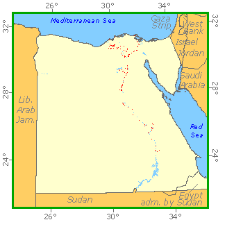
Egypt is lightly forested with forest cover amounting to much less than 1 percent of the country’s land area. The vast majority of Egypt’s vegetation occurs in the Nile valley and on the river delta. Almost all the substantive forest is plantation forest, with Populus spp. and Eucalyptus spp. most common. Egypt has virtually no natural forests. Areas of mangroves occur around the Red Sea, and palms fringe parts of the country’s coastline. The date palm (Phoenix dactylifera) is the most widespread indigenous tree. The arid Sahara and Sinai deserts constitute 96 percent of the country’s area and have sparse and scattered scrub vegetation characterised by Tamarix aphylla, Acacia spp. and Leptadenia spp. Relict woodland occurs on the slopes of some mountains. Egypt has around a dozen protected areas, the largest being the 500,000 hectare Gebel Elba conservation area.
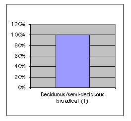
Forest Types
Geographic Description
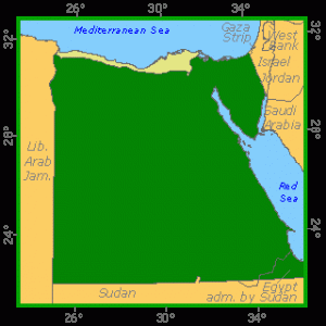
The Arab Republic of Egypt is located in the north-eastern corner of Africa and south-western Asia. It is bounded on the north by the Mediterranean Sea, on the east by Israel and the Red Sea, on the south by Sudan, and on the west by Libya. The country is about 1 085 km from north to south and about 1 255 km from east to west. It has a total area of 1 001 450 km2.
Little rain falls in Egypt, and more than 90 percent of the country is desert. The Western Desert, also called the Libyan Desert, is part of the Sahara desert that stretches across northern Africa. It covers about two-thirds of Egypt’s total area. The Eastern Desert, or Arabian Desert, to the east of the Nile is also part of the Sahara. The Sinai Peninsula is a desert area that lies east of the Suez Canal and the Gulf of Suez. Egypt’s highest point, Jabal Katrinah (2 637 m) is located in the southern Sinai. In the extreme south, along the border with Sudan, is the Nubian Desert.
The Nile enters Egypt from Sudan and flows north for about 1 600 km to the Mediterranean Sea. For its entire length from the southern border to Cairo, the Nile flows through a narrow valley lined by cliffs. In the far south, Lake Nasser, formed by the Aswân High Dam, extends across the Sudan border. In the vicinity of Cairo the valley merges with the delta, a fan-shaped plain on the Mediterranean coast. The delta measures about 240 km at its base along the Mediterranean Sea and about 160 km from north to south. The Suez Canal traverses the Isthmus of Suez between Africa and the Sinai Peninsula.
The climate of Egypt is characterised by scorching summers from May to October and a cool season from November to April. In the coastal region average annual temperatures range from a maximum of 37° C to a minimum of 14° C. Wide variations of temperature occur in the deserts, ranging from a maximum of 46° C during daylight hours to a minimum of 6° C after sunset. During the winter season desert temperatures often drop to freezing. The most humid area is along the Mediterranean coast, where the average annual rainfall is about 200 mm. Precipitation decreases rapidly to the south. Cairo averages only about 29 mm of rain a year, and in many desert locations it may not rain at all for several years.
Ecological Zones
Forest Industry
Forest Map