Forest Resource
Overview
Niger is lightly forested with around 2 percent forest cover and an additional 6 percent of other wooded land. The northern two-thirds of the country extend into the Sahara desert and vegetation in the desert regions is sparse or non-existent outside oases. Niger’s forests mainly comprise open Sudanian-Sahelian savannah characterised by species such as Isoberlinia doka and Tamarindus indica. The southeast of the country extends into Sahelian vegetation comprising mainly Acacia spp.and Combretum spp. scrub. Closed forests occur only as occasional galleries along the banks of the Niger river in the south. Desertification and persistent drought are major problems in Niger. Niger has established a modest area of plantations primarily using Acacia spp. The country has a modest network of protected areas including the 8-million hectare Air and Tenere National Nature Reserve. From a forest perspective, W du Niger National Park is the most important. Around 16 percent of the country’s forests are in protected areas.
Forest Types
Geographic Description
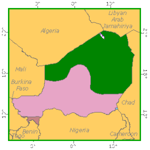
The Republic of Niger, located in western Africa, is bounded on the north by Algeria and Libya, on the east by Chad, on the south by Nigeria and Benin, and on the west by Burkina Faso and Mali. It is a landlocked country with an area of 1 267 000 km2 and lies between latitudes 11° 37´ and 23° 23´ N and longitudes 0° and 15° E.
The terrain is composed of the continental African base covered by sediment and débris and smoothed by erosion. The altitude of this monotonous landscape ranges from 200 to 500 m. However, there are some very old or volcanic mountains – the Tamgak mountains (1 800 m) in Aïr in the north-west, overlooking the Iferouane valley – and the vast expanse of the Ténéré dunes. Altitudes also rise sharply in the north-east on the border with Chad and north of Zinder in Damergou. In the south-west the Niger River flows for 300 km from the border with Mali to Gaya over a large plain cut by dry valleys. In the south-east the country encompasses the north-west bank of Lake Chad.
The country has over 500 000 km2 of Saharan desert, including the Ténéré. The remainder of the country is comprised of the following climatic zones:
- The Sahelo-Saharan zone, covering some 450 000 km2, with an annual rainfall of 100 to 350 mm;
- The Sahelian zone proper, covering about 200 000 km2, with an annual rainfall of 350 to 550 mm;
- The Sudano-Sahelian zone, represented by a narrow strip in the south and a small Sudanian enclave in the south-west on the borders with Benin and Nigeria, with an annual rainfall of 550 to 850 mm.
The rainy season lasts from June to October in the south, with maximum rainfall in August, but gets steadily shorter further north as the rain becomes more irregular and lighter. The dry season, from October to June, is hot until November, then relatively cool until mid-March, and very hot again in April and May with a burning east wind. Higher areas, especially in Aïr, receive more rain than low, desert-climate areas. The average annual temperature at Niamey, in the south-east, is 29° C, but temperatures can reach as high as 50 °C in the desert.
Ecological Zones

Forest Industry
Forest cover Vegetation The natural vegetation of the region has been strongly affected by human interference and is now very sparse so that its present composition is only a pale reflection of what it was originally. The following zones can be distinguished:
- A Saharan region of thorn steppe with some palms, particularly the doom (Hyphaene thebaica) and date palms (Phoenix dactilifera);
- A Sahelo-Saharan tree or shrub steppe with abundant grasses, suited to nomadic pastoralism;
- A Sahelian bushland of Combretum – a farming area;
- A more typical Sahelo-Sudanian zone, particularly in a large fossil valley, the Dallol Maori, which flows into the Niger River. There are savannah woodlands in the dry central areas becoming richer in species in the south where gallery forests are also found.
It is important to remember that the Niger was one of the countries worst hit by the 1967-1974 drought and that the forests damaged or destroyed during that period have not reconstituted themselves.
Closed Forests Broadleaved
These are the tree savannahs found in the Sahelo-Sudanian zone where forest stands have been extensively encroached upon or practically eliminated. Nevertheless, there are still a few small islands of closed savannah woodland south of Niamey and in the Say region. Typical species here include the tamarind (Tamarindus indica), shea (Butyrospermum parkii), kapok (Bombax costatum), locust bean (Parkia biglobosa), Combretum glutinosum and Cassia sieberiana, as well as Hyphaene thebaica, Borassus aethiopium and Parinari macrophylla in the moist savannah zone.
Open forests Broadleaved
These are made up of the few gallery forests in the south of the country where Sudano-Guinean species are found and a few flooded closed borassus palm stands in the areas with more scattered borassus palms. Gallery species are those of the tree savannah described below, plus the Sudano-Guinean species Lannea acida, Pterocarpus erinaceus, Khaya senegalensis, Daniellia oliveri and Burkea africana.
Other wooded land Shrubs
These are the tree or shrub steppes found in Sahelian and Sahelo-Saharan zones. There are areas of striped bush, where it is hard to tell whether this is a climatic feature or the result of degradation. The Sahelian steppe is marked by the occurrence of Combretum scrub. The gum (Acacia senegal) proliferates especially in the east of the country, and Acacia albida encroaches on farmland. The borassus (Borassus aethiopium) and doom (Hyphaene thebaica) palms are also present. The trees most commonly found in the Sahelo-Saharan steppe are Acacia raddiana, A. seyal and, to a lesser degree, Commiphora africana. Thorny vegetation (Acacia raddiana) is found in combination with doom palms near the boundary with the Saharan zone.